Welcome to our (very personal) reviews of the campsites we have visited. If you arrived here from a link on our travel blog, Semi-True Tales of Our Life On the Road, you can click here to read all of our campground reviews.

If you would like to know more about me, or contact us, click on "Who are We?" (to the right). For more information about what you can expect to find in these reviews, click on "About These Reviews". Finally, a note about the photos: hover your cursor over a photo to read the caption, or click the photo to enlarge it.

Thursday, December 30, 2010

THE FORTUNA FOOTHILLS, YUMA, AZ

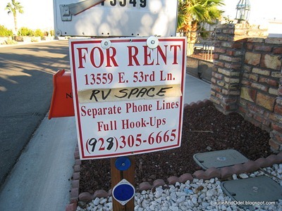
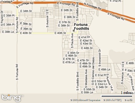
6665 signNot a campground, the “Fortuna Foothills” (usually just called The Foothills) is a sprawling, RV-friendly development of privately owned lots 10 miles east of downtown Yuma, AZ.  The area is bounded on the north by Interstate 8 and accessed from either Fortuna Road or Foothills Blvd, stretching south for a couple of miles.  The area was developed from I-8 to the south over several years, so the newest lots are south of 48th Street, with the newest and most “upscale” residential use in the southeast area.

Spacious RV sites can be rented from private owners, usually for 1-3+ months in winter.  Craigslist.com is a good source, or drive the streets and call phone numbers on the “RV Site for Rent” signs. 

Our Opinion: We liked the area south of around 44th Street, which is the part of the Foothills we explored.  We were happy with our inexpensive stay on a no-frills lot in this sunny snowbird destination.

Map picture
Date of Stay: December 25 to January 2, 2011.

Weather During Stay:  Ranged from sunny and warm to sunny and cool/cold, with a day of rain thrown in.  Usually breezy, sometimes windy.  Yuma is often windy is winter and spring.

Site Description:  We rented a gravel site on a gated double lot that had FHU for 4 RV’s, plus trash and recycling bins.  Lots of room, no frills.

The variety of residential options on these lots is amazing, ranging from graveled, no frills lots (like the one we stayed on), to lots with RV sites and patios, to casitas, park models, modular homes, and site-built homes, some selling for upwards of $300,000. 

What they all have in common: RV’s are allowed to park on all lots.  Streets are paved and wide enough to easily maneuver a big rig while turning into a gated lot.
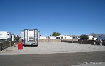
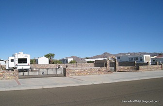
No-frill lot in the Foothills. Walled, gated, but few improvements.
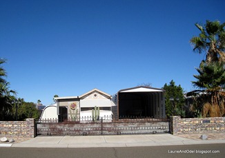
No frills lot in the foothills. Front wall, gated – a step up.

Rate:  We were told that the average monthly rate January through March is $325, which includes utilities.  Because we stayed prior to January, when the snowbirds flock to Yuma, we were able to rent short-term.  The typical daily rate appears to be $10-15, including utilities.  It is very difficult to find a short-term (less than monthly) rental during the high season.

Phone/radio/TV:  Good Verizon signal here for both phones and aircard.  Our site had no obstacles for our roof-mounted satellite TV, but some of the landscaped sites might have palm trees to avoid. The air antenna picked up several channels, including networks and a PBS station.  NPR on 88.9.
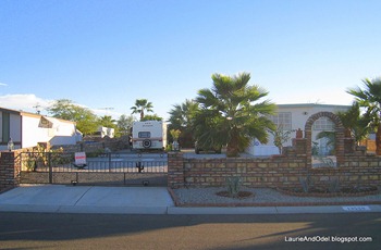
Double wide, landscaping, RV space. Typical Foothills lot that needs some TLC
Double wide modular home with RV space and landscaping. Typical lot that needs some TLC

Elevation/landscape/terrain: Not far above sea level, Yuma is one of the sunniest places in North America.  Foothills Blvd. rises slightly as it heads south from I-8, so the distant view improves as you continue farther south.  Local views are of neighboring rigs and homes; distant views are of arid, very rocky mountains. 

Lighting/noise:  NO streetlights in our area - YAY!  All nighttime lighting is low, on the 3-4 ft. high brick fences.  Very nice.  This is a very quiet area; no disturbing noise at night.

Hiking/Walking:  Walking on the wide roads is safe, easy, and interesting - good for biking, too.  Lots of variety and pretty views.
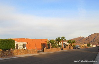
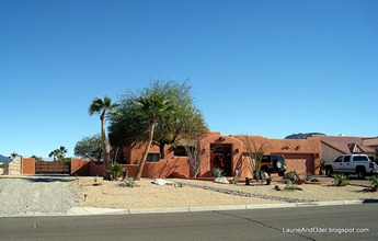
Foothills scene 1 Multi-hundred thousand dollar plus house in the Foothills
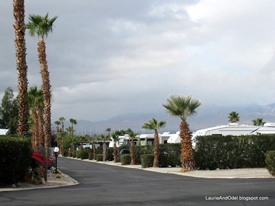
Typical scene of RV’s and a home on a wide street with palms. Couple hundred thousand dollar plus home, fully landscaped.

Comments:  Because of the difference in age between the lots closest to I-8 and those farthest away, there is a wide variety of appeal between the older lots and the newer lots.  We stayed in one of the newest areas and enjoyed it, but drove some of the older neighborhoods and found them less appealing and somewhat run down, varying from lot to lot.  If you rent via the internet, be sure to ask for photos of the site, the lot, the neighboring lots and the view across the street.

Plenty of businesses in the area, including a large Fry’s grocery store at I-8 and Fortuna Road, and a post office that accepts General Delivery mail on Fortuna Road.
Saturday, December 25, 2010

SANDS RV AND GOLF RESORT, DESERT HOT SPRINGS, CA

Pool at SandsOur Opinion: Neutral.  Since we don’t use many of the common area offerings, it’s a little high-priced for us.  Friendly and appealing, though.

Date of Stay: December 16 through 24, 2010.

Weather During Stay:  One of southern California’s worst winter storms on record brought rain and some flooding to the area.  Our last two days were sunny and pleasant.  This area gets VERY windy at times.

Site Description:  With 521 sites, this might be the largest park we have stayed in.  All sites are back-ins. Some sites are occupied by park models or RV’s that probably aren’t going to move again.  Lots of “seasonals” here, but most sites and rigs are nicely maintained. 

Sites are reasonably sized, with hedges between the sites providing privacy.  A quarter of the sites would be too sloped for us to use, another quarter appear very level, and the remainder slope to some degree.  We (and many other rigs) used boards to shore up our passenger side to help level the rig.

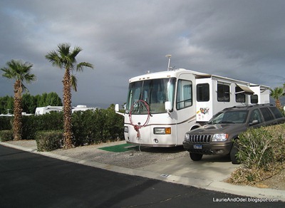
Typical Street and sitesI believe that all sites are FHU (30/50 amps).  A small number of sites have “hot” cable TV, ready to hook up, but most sites either have no cable TV hookup or are set up for long-term rental - contact the cable company for service. 

Roads are paved and reasonably wide, sites are gravel with concrete pads for a tow or towed vehicle.   No picnic tables, trees here and there (lots of palms, not a lot of shade).   One central trash area for this huge park!

While the RV sites are average, the common areas are a cut above.  Nice swimming pool (seemed a little on the small side for the size of the park), two Jacuzzis, plenty of indoor space with a shuffleboard table, several pool tables, computers, a couple big screen TV’s, comfortable seating - very, very nice.  A 9 hole golf course (extra fee, of course) tennis courts, fitness center, and an appealing dog run round out the common areas.

Rate:  We stayed on a special deal only available to first-time visitors: pay the normal weekly rate of $215 and get two additional days for free.  The “special” price (under $25/night) seemed reasonable for what was offered - not sure if we would go back at full price.  I don’t know the monthly/seasonal rates, but they are likely very reasonable if you like a park offering these amenities.

Site 163Phone/radio/TV:  Strong Verizon signal here for both phones and aircard.  WiFi (TengoInternet) is included, but we didn’t use it.  Our site had no obstacles for our roof-mounted satellite TV dish worked, and the air antenna picked up some channels.  Instant-on cable TV is an extra $3/night or $15/week - we didn’t bother.   NPR on 89.3 (or was it 89.5?).

Elevation/landscape/terrain: Around 600 feet above sea level, the Coachella Valley has arid mountain ranges on three sides.  It is obvious from the hundreds of wind mills in the area that that this area (especially Banning Pass) gets a LOT of wind, so be prepared.  Local views are of neighboring rigs; distant views are of arid mountains (sometimes snowcapped). 

Lighting/noise:  Our site was comfortably dark at night; the low level park lighting makes it easy to see when walking or driving, but not intrusive.  Very quiet at night (except when the coyotes get going). 

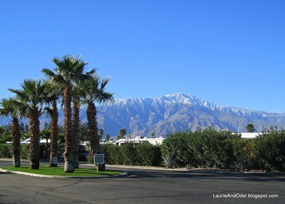
View on a fine dayFavorite Sites:  Not a lot of difference in the sites, except some back up to the desert perimeter or one of the washes that run through the park (we were told that these cost more).  The BIG difference we noticed was how level the sites were - some are very sloped.

Hiking/Walking:  Walk the big park twice for 10,000 steps.  Otherwise, drive 10-20 miles for area hikes, or 45 miles to Joshua Tree National Park.

Comments:  Not the sort of place we usually stay, but it is quite appealing if you like large parks with lots of activities.  Two grocery stores within a couple of miles. 

Wednesday, October 27, 2010

PLACERVILLE ELKS LODGE, SHINGLE SPRINGS, CALIFORNIA

Site 9 ElksOur Opinion: Recommend.  This is a newer lodge with large, level RV parking in an appealing, hilly setting.

Date of Stay: October 20 through 26, 2010.

Weather During Stay: Pleasant fall weather with balmy days and cool nights (70‘s and 40‘s) - and one huge rain storm over the weekend.

Sites: Eight 30 amp E and water sites, one 50 amp and W site.  Sites are graveled, wide, and level.  All sites are back-ins. Space available for dry camping, but it is quite sloped. NEW: As of 2012, there is now a working, on-site dump.

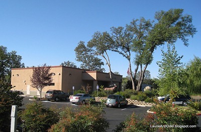
Placerville LodgeRate: Recently raised from $15 to $17, with W and E at sites. 

Phone/radio/TV: Strong Verizon signal for phones and internet.  Tall oaks may obstruct TV satellite in west-facing sites.  Several TV stations on antenna, including the three major networks and PBS.  Local NPR on 90.9 and 91.3.

Elevation/Landscape/Terrain: Flat, level parking area in a hilly landscape at 1,390’ elevation.  Views of large oaks, lodge and local light commercial businesses.

Lighting/Noise: Light road noise.  A dog-grooming and pet-boarding facility next door is sometimes noisy during the day.  Night time lighting is moderate,  high, bright “streetlight” type lighting that is more or less intrusive depending on where you are parked.

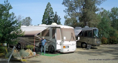
Site 9, Placerville Elks, with lodge in the background.Favorite Sites: Most sites are the same, though site 6, facing west, has 50 amps.  Site 7 is shorter than most of the other sites, the only site not suitable for a big rig

Hiking/Walking: Head south over the hill to access little used paved roads in an undeveloped area.  A California state park, Folsom Lake, is 10-15 miles away with good hiking and biking. 

Comments: A much-better-than-average Elks RV parking area convenient to shopping and services, to Sacramento, and to small, historic, Placerville. Very friendly and active lodge.

Saturday, October 16, 2010

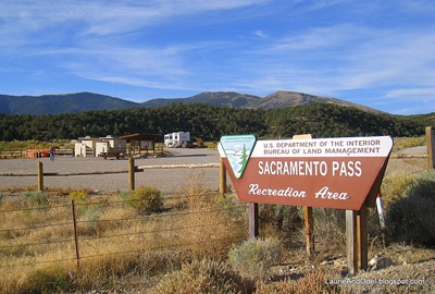
SACRAMENTO PASS RECREATION AREA SCENIC PULLOUT, NEAR BAKER, NV

Approaching from the east Our Opinion: Rave, if you don’t want/need services.  Free, convenient, quiet spot to overnight or visit Great Basin National Park.

Date of Stay: October 15, 2010.

Weather During Stay:  In the 70’s when we arrived as the sun set, dropping to 40 for an overnight low.

Site Description:  This very large, scenic BLM pullout does triple duty as a picnic area, informal campground, and the trailhead for the Sacramento Pass trail, open to hikers, bikers, and horses.  It is located around 8 miles west of Hwy 487, the road that heads south to Baker and to Great Basin National Park from Hwy 50.  Our GPS shows the coordinates as N 39.12105, W 114.30559.  The pullout is on the south side of the highway, at Osceola Road (CR-35, gravel).

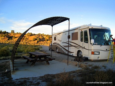
The pullout and loop roads are dirt/gravel.  A pit toilet and trash cans are located near the entrance, along with a couple of picnic tables and shade trees.  From there, a loop road climbs uphill, with large pullouts equipped with heavy, old picnic tables and sloped shade/wind shelters - 5 in all - against the very scenic backdrop of Wheeler Peak in an area of sage and evergreens. 

Our site as the sun set. Roads are wide, well-graded, and easily negotiated with a big rig. Besides the sites with picnic tables, there is additional space available for parking that could be used if the shelter areas were all occupied.   In addition, a slightly more primitive road continues uphill from the back of the upper level, with another set of pit toilets and additional parking around 1/2 mile farther (better for smaller rigs).

Rate:   Free.  No hookups.  No potable water.  No dump station.

Phone/radio/TV:  No Verizon service for phone or aircard.  No obstacles for satellite TV dish.  No NPR stations, or any other radio stations!

Elevation/landscape/terrain: This scenic pullout is located along Hwy 50, “The Loneliest Highway in America”, at 6,720 feet - a few miles east of the summit of Sacramento Pass.  As I write this, looking south towards Wheeler Peak (in Great Basin National Park) in mid-October, there is a blanket of snow on the mountaintop (13,000+ feet).  We are in rocky, rolling foothills, with a fairly thick covering of short, chubby pines, junipers and sagebrush.  Very, very appealing.

Lighting/noise:  VERY dark once the half-moon set.  The extreme quiet was broken very infrequently by a passing vehicle on Hwy 50.

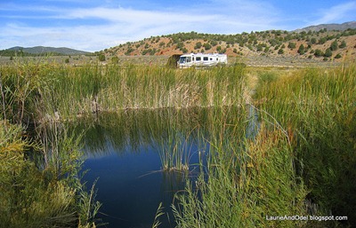
Looking west across the central pond to our site. Favorite Sites:  They’re all good!  We’d pick whichever open site was most level.

Hiking/Walking:  The Sacramento Pass trail made a wonderful walk in the morning.  Easy to moderate.  Several loops provide hikes of varying lengths; we hiked 4 miles.

Comments:  We’ve visited remote Great Basin National Park twice before and have found that sites suitable for big motor homes are very limited.  After we almost torqued our windshield out on our last visit, we decided this Scenic Pullout looked like a better alternative (it is a 15 mile drive to the national park from here).  It looks like the other campers have the same idea – 3 sites were occupied when we arrived.  Though we are moving on after an overnight, this would be a fine place for longer stay while exploring the park.

Wednesday, October 13, 2010

OK RV PARK, MOAB, UTAH

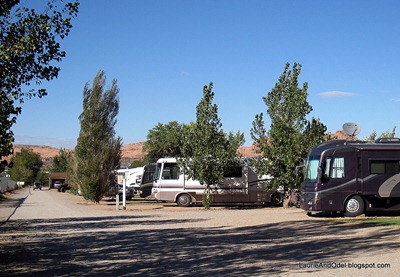
Sites along the entrance road face west Our Opinion: Recommend, if you have Passport America or CCUSA.  At the discounted price, it is a real bargain for this area.

Date of Stay: October 7 through 14 , 2010.

Weather During Stay:  Perfect!  Sunny, with highs between 70 and 75 degrees; lows in the upper 40’s.

Site Description:  The 76 sites in this mellow park come in a huge variety of configurations, including many suitable for big rigs (and many NOT).  Fifty-five of the sites are pull-throughs.  The section of sites in front is comprised of two long rows running parallel to the entrance drive, facing west; past the office halfway back, the rows run east and west, with most of the sites facing north.  It appears that all sites are FHU (30/50 amps), with cable TV included. 

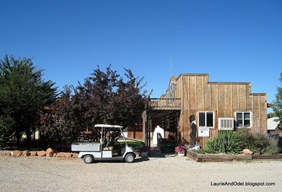
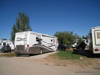
Cute little office areaRoads are dirt/gravel (and dust), as are sites.  Many sites have trees that provide some shade, and most have grass and a picnic table.  Sites are reasonably roomy for a commercial park; we had plenty of space for slides and our awning, with a grassy side yard for our chairs and picnic table.  Though our site was level, others in our row were not - we saw at least a couple long MH’s with their front wheels off the ground.

The little office complex is cute, with an appealing shaded outdoor seating area and restrooms.  Friendly, helpful, mellow staff offer plenty of brochures and advice to make your visit to Moab a good one. 

Rate:  This park participates in both Passport America and CampClubUSA.  We stayed for 8 nights at PA rates ($19.06, which included a $2/night surcharge for 50 amps and tax).  I don’t know if there are restrictions on length of stay at discounted rates.

Pullthrough Site 17Phone/radio/TV:  Excellent Verizon signal here for both phones and aircard (blazing fast).  WiFi is included, but we didn’t use it.  Our site had no obstacles for our roof-mounted satellite TV dish, and the included cable TV had dozens of channels.  NPR on 91.7.

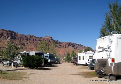
Elevation/landscape/terrain: Located at around 4,200 ft., this is one of very few commercial RV parks in Moab that is not located on the main road, Hwy 191.  Local views are of neighboring rigs or the adjacent horse stables and arena.  Distant views are of red rock cliffs.

Lighting/noise:  Our site was comfortably dark at night.  Even though the park is not on Hwy 191, road noise was still noticeable at night with the windows open… but the noise level was acceptable to us.

Favorite Sites:  Though the large sites along the entrance driveway looked appealing, they face west, right into the setting sun.  For us, that means the front curtains have to be closed much of the time - I don’t like that!  We preferred the area in the rear, where our site faced north.

Looking down our row Hiking/Walking:  No trails take off from here, but this area is FULL of great hikes.

Comments:  Though there is a lot of boondocking in this area, and BLM campgrounds in nice spots with low prices, if you want hookups, you will be at a commercial park - most of which charge between $35 and $40/night.  This park is a great deal for the (discounted) price!  The only (minor) drawback is its location 5 miles south of downtown Moab, which meant we were frequently driving through busy downtown Moab to reach Arches National Park and the Colorado River.  Just a mile or two from Moab Golf Course, though, so Odel was happy.  We will stay here when we return, thanks to the reasonable cost and mellow management.

Thursday, October 7, 2010

WONDERLAND RV PARK, TORREY, UTAH (CAPITOL REEF NATIONAL PARK AREA)

Our View on the patio side. Our Opinion: Neutral.  Good central location for exploring Capitol Reef National Park and the spectacular surrounding area.

Date of Stay: September 28 through October 6, 2010.

Weather During Stay:  “Unseasonably warm” (mid-80’s) for several days, cooling into the 60’s later in our stay, with a couple days of rain (flash flooding in Capitol Reef).  Lows in the 50’s and 40’s.

Site Description:  This small RV park (30+ sites) has both back-ins and large pull throughs, with a separate grassy area for tents.  All RV sites have FHU, but I’m not sure whether both 30 and 50 amps are available in all sites. 

Sites are reasonably level, though the pull throughs slant a bit from back to front (seems to be the norm in all the RV parks in Torrey).  Roads and sites are gravel.  Sites are surrounded by well manicured, green grass and each has one or more trees - including apple trees, with ripe fruit during our stay.  Each site has a picnic table.

Looking towards Site 13, with pull through sites on the right.Bath house and laundry on site, and a couple of cabins are available for rent.  There is an extra charge to use the showers (!), and our neighbors described them as lacking in privacy.

Rate:  This park participates in CampClubUSA, good for one night only.  For our first night, we paid $20.95 (cash only), the CCUSA rate (½ price, plus extra fees for 50 amp and??).  For the remaining nights, we got the 10% Good Sam discount, paying $29.77 per night (including taxes) for our 50 amp FHU site.  Might have been a weekly rate if we had been more organized about our stay. 

Phone/radio/TV:  We are on the edge of the Verizon signal here, but our phones and aircard did work.  We often used the park-provided WiFi (no extra charge) instead of our aircard; sometimes it was blazing fast, sometimes it crawled.  With just a little back-and-forth, we found a shot past a tree so our roof-mounted satellite TV dish worked.  Cable TV is provided, but we preferred using the air antenna, which brought in 20 stations far more clearly than the cable TV signal.  Local NPR on 94.5.

Site 13Elevation/landscape/terrain: Located at 6,800 ft. in a beautiful setting, this park is quite appealing.   Local views are of the green grass and trees of the park and adjacent green pasture.  Distant views are of red rock cliffs and big skies.

Lighting/noise:  Most sites are reasonably dark at night; an unlucky few are near tall night lights.  Even though the park is on the corner of the two main highways in the area (US 24 and US 12), traffic noise at night was not obtrusive for us.

Favorite Sites:  We were in what appeared to us to be the best site in the park, site #13 - which had just been vacated by its seasonal resident when we arrived.  It is a roomy back-in adjacent to the grassy common area with shade trees and beautiful views, facing east.  NICE, except that some of the trees bleed onto things below them.  We’ll see how difficult that is to clean up.   The sites backing up to Hwy 24 would be our last choice.

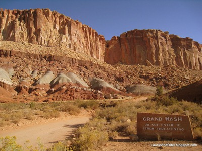
Grand Wash road Hiking/Walking:  No trails take off from here, but this area is FULL of great hikes.

Comments:  This is one of several RV parks in Torrey.  We like some things about the park (location, trees, small size), but had some minor annoyances (intermittent WiFi problems, poor reception on the cable TV, somewhat brusque owners).  We had no real complaints, but might give one of the other campgrounds in Torrey at try next time we come to the area.  Bring groceries, the nearest “large” grocery store is about 20 miles away.

Monday, September 27, 2010

CANYON VIEW RV PARK, SPANISH FORK, UTAH

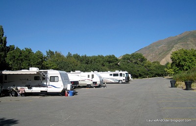
Site 11-24, in the first parking area (entrance at the rear of this photo) Our Opinion: Neutral.  Quiet, easily accessed and inexpensive.

Date of Stay: September 26 and 27, 2010.

Weather During Stay:  Hot days, cool and windy nights.

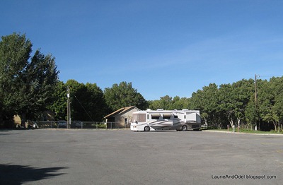
Site Description:  This is a paved parking lot for RV’s on the edge of a pretty, green, municipal park.  Each of the 24 sites has a shared electric box (two 30-amp plugs) and water spigot at the back of the site. No sewer connections, but there is a dump on-site.

Sites are reasonably spacious, backing up to a bit of grass and thick tree cover with picnic tables.  The only restrooms are down the hill, through the trees, in the day use picnic area, so this park works best for self-contained RV’s.

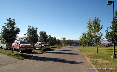
We were in Site 2 The parking area has two sections.  Sites 1-10 are farthest to the west, and the dump station is also located there, at the farthest end of the parking area - a very awkward location if site 1 was in use.  Sites 1-8 are best for big rigs, but we saw a big motor home parked in the first area (sites 11-24), too.

Rate: $12/night for 30 amp E and W.  Fill out an envelope and pay the iron ranger.

Phone/radio/TV:  Strong Verizon signal for phones and aircard.  No obstacles for the roof-mounted satellite TV dish.  No cable TV here, and we didn’t try the antenna.  Local NPR from Salt Lake City on 91.1.

Elevation/landscape/terrain: Spanish Fork is at 4,500 ft, at the foot of some VERY DRY mountains.  The green of the grass and trees of this municipal park were very welcome.

Lighting/noise:  Very dark and quiet at night.

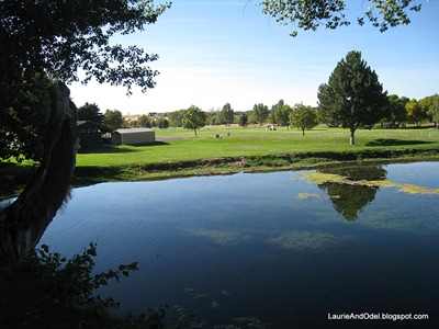
Canyon View Park Lake, down the hill from the RV campground Favorite Sites:  Big rigs should go into the second parking area where the sites are a bit longer.  We’d avoid site 1 because of the placement of the dump station.

Hiking/Walking:  You can stroll through the park (down the hill, through the trees behind the campsites), but we didn’t find any easily accessed long walks/hikes.

Comments:  This park was about ¼ full when we visited.  Good bargain.  Grocery shopping within a couple of miles (back towards I-15).  Odel paid $20 to play 18 holes at the golf course that surrounds the park.  We would stop again if we wanted to overnight in the area.

FORT HALL CASINO RV PARK, FORT HALL, IDAHO (POCATELLO AREA)

Casino in background Our Opinion: Neutral.  Made a good overnight stop just off I-15 near Pocatello.

Date of Stay: September 25, 2010.

Weather During Stay:  Warm, dry afternoon and a cool evening.

Site Description:  The 40+/- sites in this tidy casino campground are all pull-throughs, all reasonably long, and all narrow.  All have FHU with 20/30/50 amps. 

Roads and sites are paved, with the pavement just barely wide enough for a rig.  With the exception of 6 or 7 sites on the far end of the campground, sites are separated from each other by a 4 or 5 foot wide strip of grass, over which slides and awnings extend.  Very tight!  

Between the inadequate width of the sites and the odd placement of the utilities, it would be quite uncomfortable to be sandwiched between close neighbors.

Grassy recreation area and restroom Onsite restrooms with showers, and a large expanse of green lawn for recreational use.  If you drive a big rig, beware of the A row of sites (the first row as you enter the park) - the turn at the end of the row to exit is too right for a large rig, requiring you to back out of your site or drive against the traffic pattern.

Rate:  $20/night for FHU.  Pay the cashier in the miserably smoky casino.

Phone/radio/TV:  Strong Verizon signal for phones and aircard.  No obstacles for the roof-mounted satellite TV dish in most sites (except those behind the single clump of large trees).  No cable TV here, and we didn’t try the antenna.  Local NPR from Pocatello on 91.1.

Elevation/landscape/terrain: Located at around 4,400 ft, with plenty of green grass and many recently planted smaller trees, the park is fairly visually appealing.  Views are of the casino, the adjacent service station, and dry countryside.

Lighting/noise:  Reasonably dark at night.  Noise from nearby I-15, but not overwhelming.

Our site, A-14 Favorite Sites:  Half a dozen of the sites in the back of the park had much larger grassy areas dividing them from their neighbors, so would be far superior when/if the park was full.

Hiking/Walking:  Nothing pleasant.

Comments:  We wanted to stop early in the day and visit the Costco in Pocatello.  Too hot to dry camp (which is allowed for one night in the gravel lot behind the service station), this park, not half full, worked well for us.  Very convenient access to I-15, but far enough away that the traffic noise was not annoying.

Saturday, September 25, 2010

JUNIPER CAMPGROUND, RIRIE, IDAHO

Our Opinion: Recommend, if you want to get away from it all - nothing much around here.

Pull-outs in the A Loop Date of Stay: September 22 through 24, 2010.

Weather During Stay:  Balmy fall days and cool nights; very windy afternoons and evenings.

Site Description:  What a mix of sites!  The campground, with a large reservoir on one side and agricultural fields on the other, consists of 2 paved loops with 40+ paved sites and a grassy area for tents.  Perhaps a third of the sites have a large enough flat spot for a big rig - the rest (mostly back-ins) are either too short or two sloped for big rigs. 

The utilities are also a mix.  Most sites are FHU, with at least 20/30 amps, but several sites have 50 amps.  Some of the developed, paved sites have no utilities at all, and one has 30 amps and water, no sewer.

Sites are very spacious, and each site has a concrete picnic table and a large fire ring.  Well-watered and manicured grass surrounds all of the sites, dotted with appealing juniper trees.  Each loop has a restroom, and the picnic table has its own.

We were in Site B13 Rate:  $18/night for FHU, $16/night with a Golden Age Pass.  $10/night for tent sites. 14 day limit.

Phone/radio/TV:  Strong Verizon signal for phones and aircard.  No obstacles for the roof-mounted satellite TV dish.  No cable TV here, and we didn’t try the antenna.  Local NPR from Rexburg on 100.5.

Elevation/landscape/terrain: Located at around 4,900 ft., this park feels very remote (nearest town, tiny Ririe, is 4 miles away).  The irrigated grass is very appealing.  Local views are of grass, junipers, and neighboring rigs; distant views are of open agricultural fields and big skies.

Lighting/noise:  Very dark at night - the only lighting came from inside the restrooms.  Very quiet when we visited (but the park was virtually empty).

Favorite Sites:  These are the sites that will accommodate a big rig reasonably well, mostly pull-outs but a few are backins:
50 amps - A8, A20, B3, B6, B10, B13 (our site), B15, B17, B19, B20
30 amps - A14 (no sewer), A17, A23, A25, A26, B4, B12
No HU: A10 and A12, both quite private with great water views.

A no-hookup site in the A LoopHiking/Walking:  Walking the campground loops is pleasant, and some primitive trails wind through the undeveloped area of the park.

Comments:  This park was almost empty when we camped here, a few days after the “close of the season”.  The nearest grocery store is 20 miles away in Idaho Falls, so bring food with you!  We were told the place fills up in summer, especially on weekends, so reservations are a good idea.  Locals come here to picnic, boat, swim.

Sunday, September 19, 2010

GROS VENTRE CAMPGROUND, GRAND TETON NATIONAL PARK, WYOMING

Loop A from a distance Our Opinion: Recommend.  No hookups, just a pretty campground in a gorgeous national park.

Date of Stay: September 16 through 21, 2010.  This is our second stay - the first was in June of 2004 and nothing appears to have changed.

Weather During Stay:  Mild fall weather: mostly sunny days in the 70’s and cool nights.  

Site Description:  Located at the south end of Grand Teton National Park, Gros Ventre Campground has over 300 sites, arranged in seven loops and along the “main road” that ties the loops together.  Just one of the loops has utilities, and it houses national park employees and volunteers – no campers. 

Typical campground road None of the remaining 6 loops have utilities, and three of the loops do not allow generators.  At the time of this visit, generator use was allowed in loops A, C, and D, and in sites along the main road linking the loops. 

Each loop has two bathrooms with flush toilets (no showers), a water faucet, and a bear-proof trash container.  A dump station is located at the park entrance/exit, with potable water.

Loop roads are narrow and paved.  Sites are mostly level and graveled, all back-ins of varying sizes.  Many small sites, many medium sites, and far fewer sites for big rigs.  VERY few sites to accommodate rigs over 40 feet.  All sites have a heavy picnic table and a fire ring, and spaces are backed by cement and log barricades.  To allow our rear end to hang over the barricade (so our front end was off the road), we set the jacks manually WITHOUT dumping the air suspension.  It was obvious many diesel motor homes had taken the same precaution to avoid fiberglass damage on the barricade.

Rate: $20/night, $10/night with a Golden Age pass.  No reservations; all sites are first come, first served.  This is one of the last campgrounds in the park to fill, and frequently doesn’t fill.

Site 147, C Loop - barely off the road Phone/radio/TV:  Verizon phones and aircard worked without a booster or amplifier.  Our satellite TV dish was able to find a signal through the trees.  We didn’t bother trying the air antenna.  Local NPR on 90.3.

Elevation/landscape/terrain: Located around 6,500 ft., this flat campground is a very short walk from the Gros Ventre River.  Very tall deciduous trees throughout the campground provide shade and obstacles for satellite dishes.  Views are of you neighbors, the tall trees, distant hills, and the occasional moose.

Lighting/noise:  VERY dark and quiet at night!  Each bathroom is lit by inside lights and a few dim outdoor lights, so not a problem.

Favorite Sites:  We were in site 147, barely long enough for us.  No real favorites here, though we preferred Loop C.  Loops A, which seems to have most of the longer sites, is very open with little privacy or shade.  Most of the rigs there were big.  Loop B didn’t allow generators, so that was not a choice for us.  Loop C has trees, but is not too heavily forested, while Loop D was quite shady.  If you are in a big rig, your choices will be somewhat limited.

Another view of loop C Hiking/Walking:  Plenty of exercise walking the loops of the campground and exploring the river, but the park is loaded with good hikes, most within no more than a 30 minute drive.

Comments:  Stop at the office to register when you enter.  If you have a specific site in mind, they know whether it is open or not.  Otherwise, you will be assigned a site based on the size of your rig and any special requests.  Pay, and proceed to your site.  There is plenty of space to hook or unhook a towed in the amphitheatre parking area just off the main road - a good idea since the campground roads have NO place to do so.

Tuesday, September 14, 2010

TETON MOUNTAIN VIEW LODGE AND RV PARK, TETONIA, IDAHO

View of the Teton Range from near the RV Park Our Opinion: Recommend, particularly at Passport America rates.

Date of Stay: September 12 through 15, 2010, off-season (after Labor Day).

Weather During Stay:  Balmy fall days and cool nights, with occasional dramatic cloud formations.

Site Description:  This small park opened in 2005 adjacent to Teton Mountain View Lodge.  Of 22 sites (all pull throughs), 16 are FHU with 20/30/50 amps; 6 (one on each end of the three rows) have no hookups.  An additional 8 tents sites are on grass at the edge of the campground.

Sites are nicely sized, each with a bit of grass, a small tree or two, and a picnic table.  Utilities are placed between two adjacent sites, so you are very close to your neighbor on the utility side, while you pull through in opposite directions.  Roads and sites are gravel.  Sites are completely level.

A central building houses restrooms with showers, a large laundry room with reasonably priced machines, and a TV room (no cable TV at sites).  Dump station on site.

Site 7 and bathhouse Rate:  We paid the 50% off Passport America rate, $14.50/night plus tax.  A great bargain!

Phone/radio/TV:  Usable Verizon signal for phones and aircard.  WiFi is available, but we didn’t use it.  No obstacles for the roof-mounted satellite TV dish.  No cable TV here, and we didn’t try the antenna.  I found a local NPR station, but it had too much static to listen.

Elevation/landscape/terrain: Located at 6,600 ft., this park is in the wide open space of the Teton Valley, on the west side of the Teton Range (Grand Teton National Park is on the other side of the range).  Near views are of the lodge and the little town of Tetonia.  Distant views are of the peaks of the Teton Range.  Rugged, very “western”, dramatic and appealing.

Lighting/noise:  Night lighting is subdued, with a low light on each utility box and a few dim lights around the perimeter of the park.  The sounds of traffic from Hwy 33 die down late in the evening.  This is generally a quiet area.

Looking west at the almost empty park. Favorite Sites:  All of the RV sites are similar.  We chose site 7, with our door side facing the view of the Teton range.

Hiking/Walking:  Take the short walk into Tetonia, or stroll down the road on the west side of the park.  The USFS Ranger Station in Driggs (6 miles south) has information on hikes in the area, or drive Teton Pass east to the national park with all it has to offer (45 miles).

Comments:  The park was only ¼ full during our visit, a real treat.  Very friendly and efficient staff in the office.  Odel played 18 holes at The Links at Teton Peaks for $18 (walking).  Excellent grocery store and good natural foods store in Driggs, a slightly larger town 6 miles south, along with an independent book store, art gallery or two, a couple “outfitters”, banks, realtors.  We had delicious burgers in Tetonia at the North End Bar & Grill.  Lots of large, lodge-style homes in the area… looks like there is money in Teton Valley.

Wednesday, September 8, 2010

BAKERS HOLE CAMPGROUND, WEST YELLOWSTONE, MONTANA

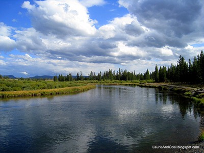
Madison River at Bakers Hole Campground Our Opinion: Recommend.  Low fees, level sites, 3 miles from west entrance of Yellowstone National Park.

Date of Stay: September 7 through 10, 2010.  This is our second stay - the first was in June of 2004 and nothing appears to have changed.

Weather During Stay:  We had it all: warm sunshine, cold rain, wind and calm.  No snow, but some cold nighttime temperatures.

Site Description:  Just off of Hwy 191, 3 miles north of West Yellowstone, this USFS campground has 72 developed sites, 33 with 30/50 amp electricity, the rest “primitive” (no electricity).  No water or sewer at sites.

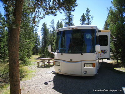
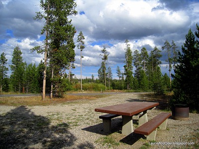
Loop roads are narrow and paved.  Sites are level and graveled, with plenty of space between sites.  Lots of pines throughout the campground, often close to the road.  About ten sites are large pull-outs alongside the loop road, but the majority of the sites are back-ins of varying sizes.  Many sites can accommodate big rigs.
Bakers Hole Map SignAs you enter the narrow entry road, a sign to your left shows a map of the campground loops next to the self pay station.  Ahead, another sign identifies sites 25 through 72 as best for larger rigs.  In this loop, the sites with E come first, and these sites fill more quickly than the sites without electricity.  There is no place along the loop to stop to unhook a towed vehicle other than the road, which can be awkward (see Comment).

The smaller loop (sites 1 through 23) also has some electric sites, several of them large enough for big rigs.  In both loops, sites with E are closer to Hwy 191, and highway noise is noticeable.  Sites without E are farther from the road, closer to the Madison River, a more desirable location - but still hear some highway noise.

Pit toilets.  No showers.  No on-site dump station.  One threaded water spigot near entrance to fill freshwater tanks (in an awkward spot); numerous non-threaded spigots throughout the campground for filling buckets and water bottles.  Two on-site host couples.  Plastic and aluminum recycling and central dumpsters.  Sixteen-day stay limit, 2 pm checkout.  Open May 15 to Sept 15, depending on the weather.

Site 30 Bakers Hole Rate: $16/night without utilities.  Add $6 for E.  Senior pass holders get half off the site rate, so pay $8 for the site plus $6 for E - a total of $14/night for an electric site. 

Phone/radio/TV:  Verizon phones and aircard worked – though sometimes poorly - without a booster or amplifier.  Our site was large enough that we found an opening through the trees for our roof-mounted satellite TV.  We didn’t bother trying the air antenna, but some rigs had them deployed.  Local NPR on 91.9.

Elevation/landscape/terrain: Located at 6,600 ft., this flat campground is adjacent to the lovely Madison River for first-class fishing.  Some of the “primitive” sites have great views of the river, but most sites had views of pines and other rigs.

Lighting/noise:  VERY dark at night!  Noise from Hwy 191 is noticeable during the day and until fairly late at night - but didn’t keep us awake.

Typical primitive site. Favorite Sites:  On our first visit, we were in site 29, a roomy, level back-in.  This time, we took site 30, a huge pull-out.  Both worked fine for us, as would many others, including pullouts 20 and 22 in the smaller southern loop.

Hiking/Walking:  Pleasant walking along the riverbank, and the hosts have advice about longer walks from the end of the northern loop - but the really good stuff is in nearby Yellowstone National Park!  Walk the outside of the combined loops for around 3,000 steps.

Comments:  All the sites in this park are first-come, first-served, which works very well for us.  We appreciate the reasonable price, the quiet campers (seems more geared to fisher folk than to families), and the easy access to the west gate of Yellowstone National Park.  West Yellowstone is nearby (groceries, gas, tourist services and entertainment).  There is a very large, signed “day use” area, suitable for trucks and big rigs, one mile south on Hwy 191 – a good place to unhook a towed before entering the campground, or for hooking up after you depart.  Since there is no dump station and the single threaded water spigot is awkwardly placed, come with empty holding tanks and full fresh water.

Monday, September 6, 2010

ROCK CANYON RV PARK, LIVINGSTON, MONTANA

Yellowstone River at Rock Canyon Our Opinion: Recommended for a relaxing interlude with convenient access from I-94.

Date of Stay: September 3 through 6, 2010 (Labor Day weekend).

Weather During Stay:  Sunny one day, rainy and cold another… a mix of cool to cold, fall-like weather.  Lows in the low 40’s.  Snow fell on the high peaks.

Site Description:  This is a small, well-tended, family run campground on the bank of the Yellowstone River.  The owners live on-site.

The map shows 23 sites, but we counted fewer - at any rate, it is small.  Most of the sites are long, somewhat narrow back-ins, but 4 nice sized pull-throughs were used by overnighters during our stay.  If the sites were all full, it might feel somewhat crowded, but we had plenty of space during our stay.

All of the developed sites are FHU, probably 50 amps, as was ours (site 20) and cable TV is provided.  The sites are gravel and grass, very level.  Most sites have a tree or two, and all sites have a picnic table.  A couple grassy areas are available for tents and overflow dry camping.   Onsite laundry (1 washer and 1 dryer) and restrooms.

Site 20 at Rock Canyon Rate: Between sending a check for a deposit, then writing two additional checks when we arrived, I don’t remember EXACTLY what we paid, but it was around $35/night plus tax.

Phone/radio/TV:  Good Verizon signal for phones and aircard.  A tree blocked our roof-mounted satellite TV, so we used the included 30+ channels available on cable TV.  Local NPR on 91.1.

Elevation/landscape/terrain: Located at 4,600 ft., this park is in a rocky canyon at the north end of the Paradise Valley.  Views are of the green grass and trees of the park, a rugged, rocky canyon wall to the west, and a high rocky ridge to the east, on the other side of the wide Yellowstone River.  Our site faced down the valley towards the high peaks of the National Park.  Because of the high canyon wall to the west, the park is shaded well before the sun sets.  Quite appealing.

Lighting/noise:  Night lighting is subdued, and there is little noise once the traffic along Hwy 89 dies down for the night.  About the ONLY noise in this park is daytime traffic noise from Hwy 89, which leads to the north entrance of Yellowstone N.P.

Looking east at Rock Canyon Campground Favorite Sites:  We liked our site (20), a long back in with a nice view to the south.  All the sites in our row (16 through 23) are similar.

Hiking/Walking:  Across Hwy 89 (adjacent to the park), a walking/biking trail stretches 2 miles back to Livingston and another mile or so to the south.  Hiking trails are available in Paradise Valley and Yellowstone National Park (55 miles south).

Comments:  We made reservations here in advance of the Labor Day weekend, to be off the road.  This small park was quiet and peaceful, not full, which surprised us!  It is rather far to the National Park from here; maybe that is why sites were available all weekend.  Like to fish?  Stand on the bank of the Yellowstone River, a few steps from your site.  We would stop here again when passing through Livingston on I-90 - the park is just a couple miles off the interstate.
Thursday, September 2, 2010

GRANDVIEW CAMP AND R.V. PARK, HARDIN, MT

Site 47 Our Opinion: Neutral.  Proximity to Little Bighorn Battlefield, easy access and large FHU sites were our top priorities, so this campground met our needs.

Date of Stay: September 1 and 2, 2010.

Weather During Stay:  Pleasant summer weather, sunny and breezy with a nighttime low in the 50‘s.

Site Description:  Around 60 sites are situated in this roomy park, a mix of FHU, electric only, and seasonal sites.  Several sites are very long pull throughs.  Roads are paved, sites are graveled and very level.

We were in site 47, a very long pull through that was easy to access without unhooking our Jeep.  As did all the sites, ours had a picnic table.  Some trees are scattered throughout the park, mostly on the perimeter, but few sites are shaded.

Large sites, wide roads Outbuildings and a few old mobile homes are scattered around.  An onsite laundry room shares the building with the restrooms and has a rack of tourist information.  Our host told us there is an ice cream social each night at 7 pm.

Rate: We paid $67.40 for two nights, which included a Good Sam Discount and tax - close to $34/night for 50 amp FHU.

Phone/radio/TV:  Very strong Verizon signal for phones and aircard.  No obstacles blocked our roof-mounted satellite TV.  40+ channels are available on cable TV.  Local NPR on 91.7.

Elevation/landscape/terrain: Located at 3,000 ft., this is classic western landscape: dry, scrubby, silvery trees, expansive views in all directions.  Lighting/noise:  Our site was reasonably dark and very quiet at night.

Long pull throughs, sites 47 and 45 Favorite Sites:  We liked our site (47), a long pull through that faced east - very welcome when the sun shone in our big front window on a cold morning.  Site 45 and 43 were equally nice.  Most sites looked spacious and level.

Hiking/Walking: We did our hiking at Little Bighorn Battlefield, 15 miles east.

Comments:  We wanted to spend a day at Little Bighorn Battlefield National Monument, and this campground served us well.  We would stay again if we wanted to spend time in the area.  The little town of Hardin has an IGA for groceries.